Where the city's adobe stands
Three houses to start with
If you read only three entries before walking Santa Fe, read these — the highest-tier landmarks in the catalog and the foundation for everything else.
 NM-SF-003 · NHL
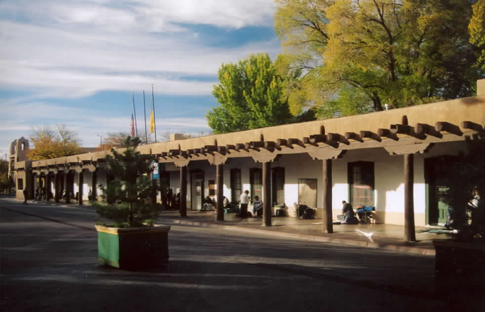
 The Palace of the Governors anchors the north side of the Santa Fe Plaza and stands as the oldest continuously occupied public building in the United States. Construction began around 1610 under the direction of Spanish…
 NM-SF-001 · NRHP
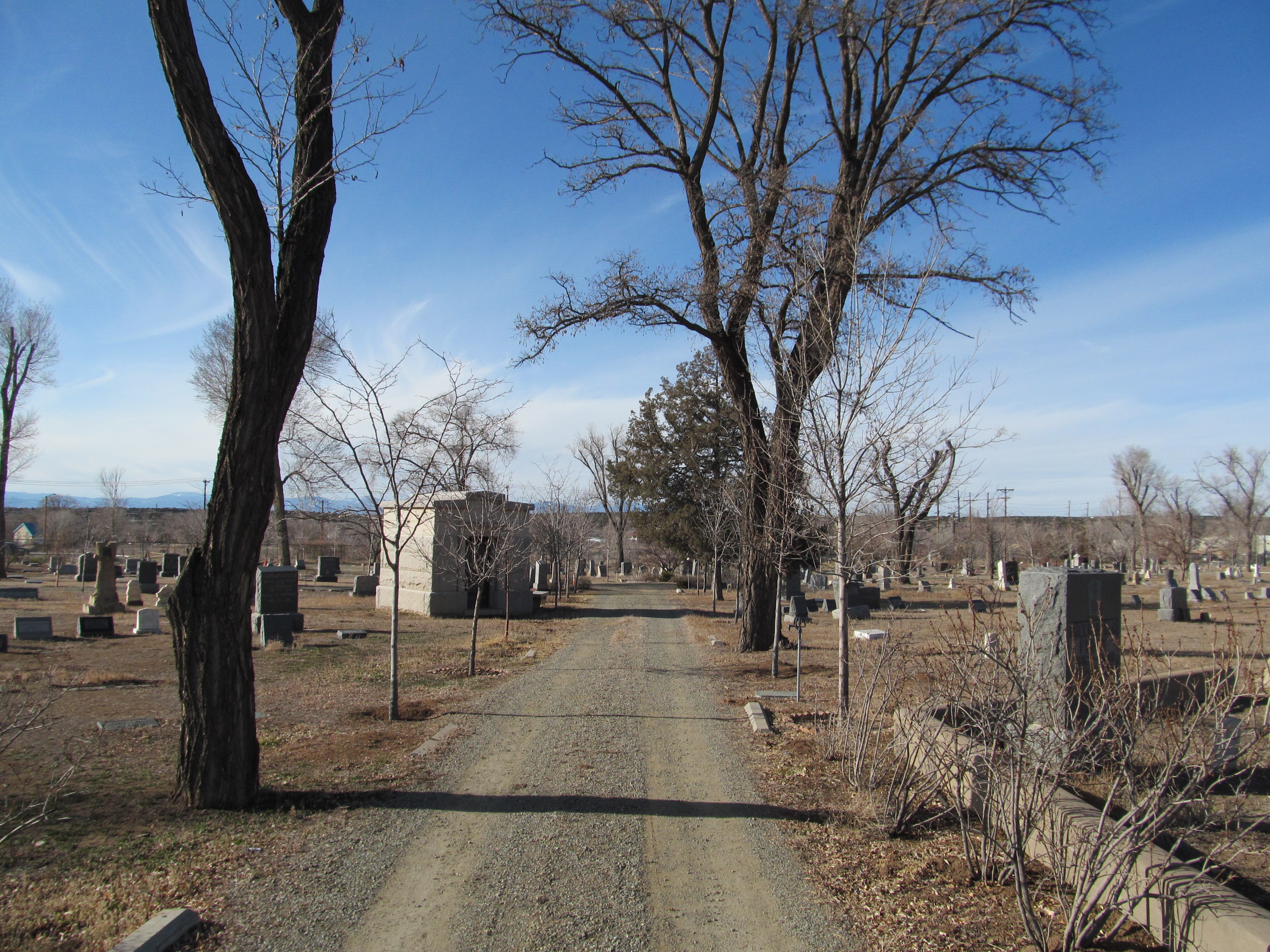
 Fairview Cemetery occupies a sloping ten-acre tract at 1134 Cerrillos Road on the southern edge of historic Santa Fe. The burial ground was established in 1884 by a consortium of Anglo Protestant residents who, unable…
 NM-SF-002 · NRHP
 The Fort Marcy Officer's Residence stands at 116 Lincoln Avenue, immediately north of the Santa Fe plaza on the slope leading up to the site of the original earthwork fort built by the United States Army in 1846. The…
Santa Fe's adobe character
No other American city has built so continuously in earth. Santa Fe was laid out in 1610 by the Spanish governor Pedro de Peralta around a central plaza, and adobe — the local clay, sand, and straw, formed and dried in the high desert sun — has been the dominant building material here for more than four hundred years.
The Plaza itself remains the city’s reference point. The long, low Palace of the Governors anchors its north side; the cathedral closes its east end; the streets that fan outward — San Francisco, Lincoln, Old Santa Fe Trail — were the principal corridors of the colonial town and remain the principal corridors today. Within a five-minute walk south of the Plaza, across the Santa Fe River, lies Barrio de Analco, the small Tlaxcalan and mestizo quarter that survived the 1680 Pueblo Revolt and the long reconquest after it. San Miguel Chapel and the so-called Oldest House face each other here on a single block of East De Vargas Street — the densest concentration of pre-1700 fabric in the United States.
East of the Plaza, Canyon Road climbs gradually along the Acequia Madre toward the foothills of the Sangre de Cristo Mountains. The road began as the trail from the Pueblo of Pecos and was lined through the 1800s with the long, single-room-deep Spanish Colonial houses of farmers irrigating from the ditch; by the 1920s those same houses had been taken over by painters, and Canyon Road became the architectural laboratory of Santa Fe Style. Across the city, north of Paseo de Peralta, an older barrio of working-class adobes still stands along Alto Street.
The look the visitor associates with Santa Fe is in fact a deliberate construction. After the railroad arrived in 1880 the city had begun to look like any other American town — pitched roofs, gable ends, Italianate brick. A small group of architects and museum directors, working from 1909 onward, reversed that trend by reviving battered earthen walls, projecting vigas, and stepped parapets; the city codified the result in its 1957 Historic Styles Ordinance, which still governs new construction in the historic district. The properties in this catalog include both the genuine survivals — the seventeenth- and eighteenth-century houses — and the early-twentieth-century Pueblo Revival buildings that defined how the rest of the country has imagined Santa Fe ever since.
Suggested walking tour
A route through the documented adobe of Santa Fe — 5 stops, measured at a researcher's unhurried pace.
From the Plaza to Canyon Road
Stops chosen from the catalog and ordered to make a coherent walk. Each stop links to the full catalog entry — addresses, dates, and photographs.
-
Palace of the Governors
Palace Avenue at Santa Fe PlazaThe Palace of the Governors anchors the north side of the Santa Fe Plaza and stands as the oldest continuously occupied public building in the United States. Construction began around 1610 under the direction of Spanish governor Pedro de Peralta, who…
-

The Oldest House
215 East De Vargas Street, Santa Fe, NM 87501 · Built c.1750The De Vargas Street House, popularly marketed as "The Oldest House," stands at 215 East De Vargas Street in Santa Fe's Barrio de Analco, the historic neighborhood settled by Tlaxcalan laborers and Spanish colonists on the south bank of the Santa Fe River.…
-
Vigil, Donaciano, House
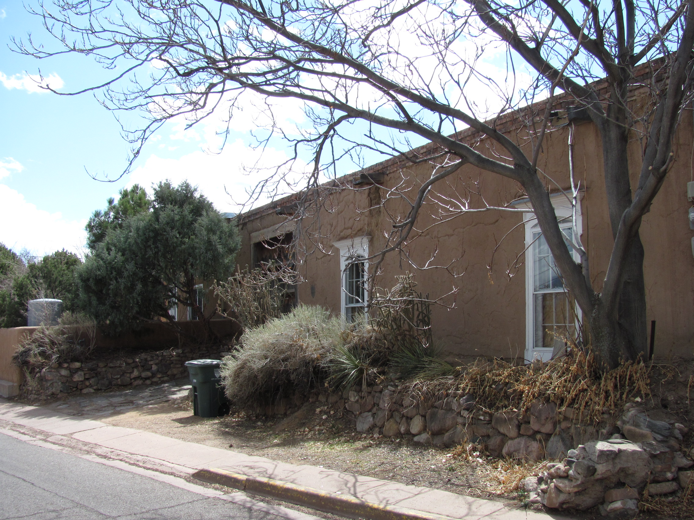
518 Alto St.The Donaciano Vigil House stands at 518 Alto Street in Santa Fe, on the historic west-side neighborhood that grew up along the acequia madre and the camino leading west out of the colonial city. The house is associated with Donaciano Vigil, a prominent figure…
-
Fort Marcy Officer's Residence
116 Lincoln Ave.The Fort Marcy Officer's Residence stands at 116 Lincoln Avenue, immediately north of the Santa Fe plaza on the slope leading up to the site of the original earthwork fort built by the United States Army in 1846. The surviving residence is one of the few…
-
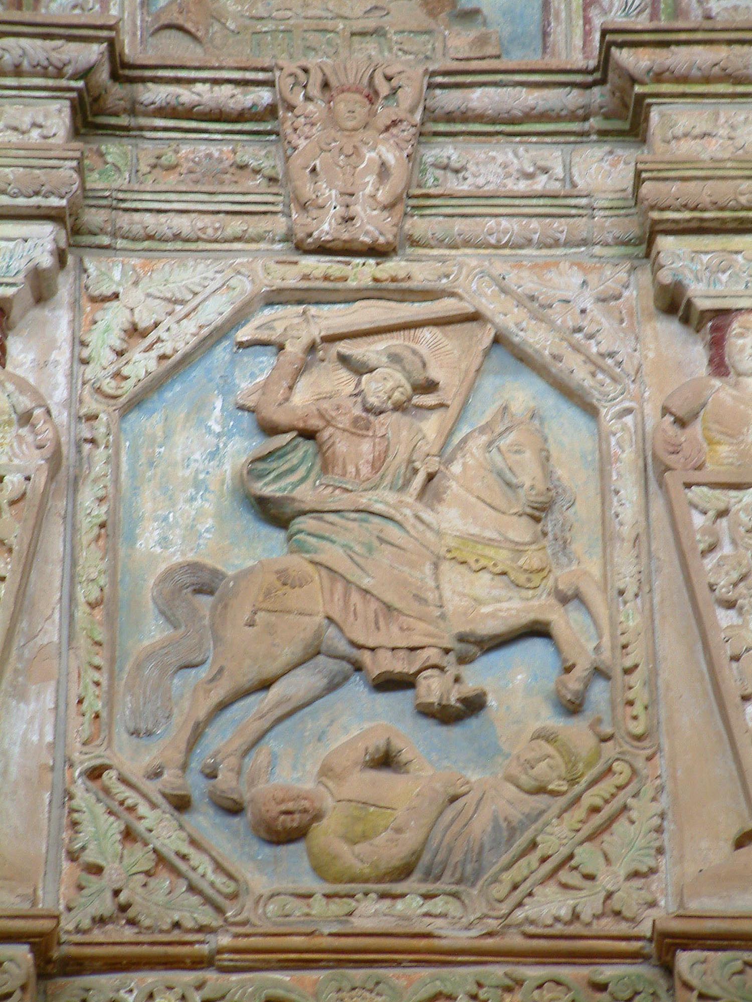
Reredos of Our Lady of Light
Christo Rey Church, Canyon Rd. and Cristo Rey St. · Built 1940The Reredos of Our Lady of Light is a monumental carved and painted stone altar screen now installed at the Cristo Rey Church on Canyon Road in Santa Fe. The reredos was originally commissioned in the eighteenth century for the military chapel known as La…
All 8 entries in Santa Fe
Documented properties in Santa Fe, listed alphabetically. Each plate carries the entry's reference number, registry status, address, and date of construction.
NM-SF-001 NRHP NM-SF-002 NRHP NM-SF-003 NHL  NM-SF-004 NRHP NM-SF-005 NRHP
 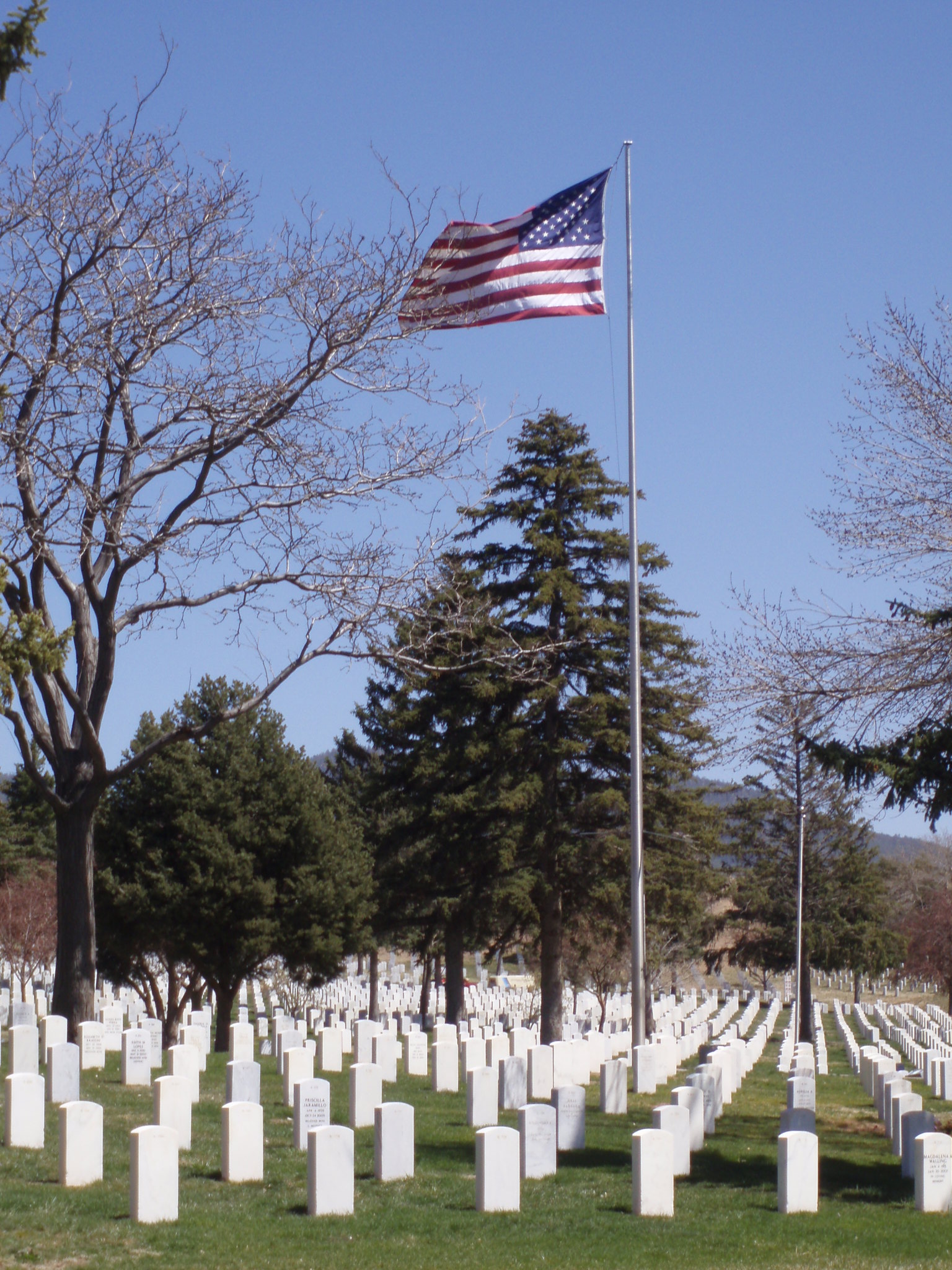 NM-SF-006 Catalog NM-SF-007 Catalog NM-SF-008 NRHP
 Nearby cities
Other adobe centers within reach of Santa Fe. Each links to its own chapter of the Atlas.